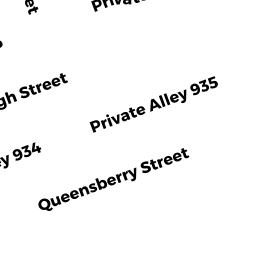
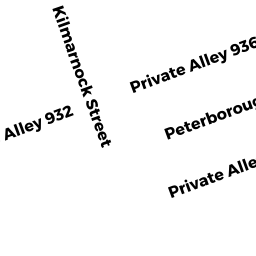
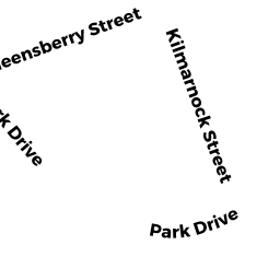
19 Queensberry ST
Owner Information
BRICKETT MARY E TRST
NORMAN A LEVENSON TRUSTEE
BOSTON, MA 02215


Property Details
19 Queensberry ST is classified as a Apartments with More than Eight Units (Apt 7-30 units).
The primary structure on this property was built in 1899. There are 19,110ft2 of built area within this property. There is 15,288ft2 of residential/living space within this property.
19 Queensberry ST is valued at $5,651,000. The land is valued at $1,868,900 and the structures are valued at $3,782,100.
19 Queensberry ST was last sold on Thursday, January 1, 1987 for $0.
Assessment data from fiscal year 2020.
Flood Data
According to the FEMA National Flood Hazard Layer, this property does not appear to be in a flood zone. It may also be in an area not yet reviewed. Nonetheless, confirm this information prior to taking any action.
To view the flood hazards around this property, create a FEMA "Firmette" Map of the area around 19 Queensberry ST.
Broadband Internet Providers
| Provider | Type | Bandwidth (mbps) | |
|---|---|---|---|
| RCN | Cable | 1000 | 20 |
| Starry, Inc. | Fixed Wireless | 200 | 200 |
| HughesNet | Satellite | 25 | 3 |
| netBlazr Inc | Fixed Wireless | 500 | 500 |
| T-Mobile | Fixed Wireless | 25 | 3 |
| VSAT Systems, LLC. | Satellite | 2 | 1 |
| Crown Castle Fiber | Fiber | 0 | 0 |
| GCI Communication Corp. | Satellite | 0 | 0 |
| Viasat Inc | Satellite | 100 | 3 |
| Verizon New England Inc. | DSL | 15 | 1 |
| Verizon New England Inc. | Fiber | 940 | 880 |
| Comcast | Cable | 1000 | 35 |
| RCN | Cable | 500 | 20 |
Broadband service provider data from December 2020.
Adjacent Properties
- 29A25 Queensberry ST
Apartments with More than Eight Units owned by L M I REALTY CORP - 30 Peterborough ST 30-28
Residential Condominium owned by WOO SHUI TONG - 24 Peterborough ST 24-08
Residential Condominium owned by KRAFT ARNOLD A - 30 Peterborough ST 30-25
Residential Condominium owned by GARDETTO MICHAEL J - 30 Peterborough ST 30-27
Residential Condominium owned by LIANG NAN - 30 Peterborough ST 30-30
Residential Condominium owned by SISON EDWIN R - 30 Peterborough ST 30-33
Residential Condominium owned by BARTUS JENNIFER - 30 Peterborough ST 30-34
Residential Condominium owned by GUZOVSKY LEE J - 30 Peterborough ST 30-35
Residential Condominium owned by MCGRATH SUSAN - 30 Peterborough ST 30-36
Residential Condominium owned by MCAULEY PETER D - 24 Peterborough ST 24-E
Residential Condominium owned by HEFFNER GARRETT C - 24 Peterborough ST 24-F
Residential Condominium owned by BELLAVANCE TRACY A - 24 Peterborough ST 24-J
Residential Condominium owned by GUGLIELMINO PAUL F - 30 Peterborough ST 30-G
Residential Condominium owned by LIN FAMILY TRUST - 30 Peterborough ST 30-H
Residential Condominium owned by KIMBALL EDWARD S - 3024 Peterborough ST
Other, Open Space owned by PETERBOROUGH GARDENS CD TR - 24 Peterborough ST 24-A
Residential Condominium owned by PETERBOROUGH AAA LLC MASS LLC - 24 Peterborough ST 24-01
Residential Condominium owned by EDELMAN GLENN - 24 Peterborough ST 24-02
Residential Condominium owned by OLUKOSHI ADEBAYO OLORUNIMBE - 24 Peterborough ST 24-03
Residential Condominium owned by DARDENO PAUL D - 24 Peterborough ST 24-04
Residential Condominium owned by BRAND WILLIAM R - 24 Peterborough ST 24-06
Residential Condominium owned by BRODSKY SASHA - 24 Peterborough ST 24-07
Residential Condominium owned by MATTA JOSEPH - 24 Peterborough ST 24-10
Residential Condominium owned by CHAN KIT - 24 Peterborough ST 24-11
Residential Condominium owned by GARCIA VASCO BENITO - 24 Peterborough ST 24-12
Residential Condominium owned by BARKER ANNE E - 24 Peterborough ST 24-14
Residential Condominium owned by CRUZ BRANDY - 24 Peterborough ST 24-16
Residential Condominium owned by TOURET XAVIER - 24 Peterborough ST 24-17
Residential Condominium owned by KEAMY MICHAEL Z - 24 Peterborough ST 24-18
Residential Condominium owned by RJP INVESTMENT TRUST - 30 Peterborough ST 30-B
Residential Condominium owned by CRM REALTY LLC MASS LLC - 30 Peterborough ST 30-C
Residential Condominium owned by PYMM MARY JO - 30 Peterborough ST 30-D
Residential Condominium owned by ARROYO MICHAEL F - 30 Peterborough ST 30-19
Residential Condominium owned by KREMER CECILIA - 30 Peterborough ST 30-20
Residential Condominium owned by LEE-CHAN FAMILY TRUST - 30 Peterborough ST 30-21
Residential Condominium owned by GRAPPO MICHAEL - 30 Peterborough ST 30-22
Residential Condominium owned by THUR PAUL - 30 Peterborough ST 30-23
Residential Condominium owned by GREELEY HELEN - 30 Peterborough ST 30-24
Residential Condominium owned by MARGARITIDIS OLYMPIA PAPPAS - 24 Peterborough ST 24-15
Residential Condominium owned by ROMERO JAVIER M - 24 Peterborough ST 24-12A
Residential Condominium owned by CHEN TIFFANY E - 30 Peterborough ST 30-32
Residential Condominium owned by AMARAL NELSON S - 30 Peterborough ST 30-29
Residential Condominium owned by PAUL F KELLY INVESTMENT TRUST - 30 Peterborough ST 30-26
Residential Condominium owned by SUN HUI - 24 Peterborough ST 24-05
Residential Condominium owned by JOHN WENDY E - 24 Peterborough ST 24-09
Residential Condominium owned by KC MGT LLC - 30 Peterborough ST 30-31
Residential Condominium owned by CRM REALTY LLC MASS LLC - 15 Queensberry ST
Apartments with More than Eight Units owned by BRICKETT MARY E TRST